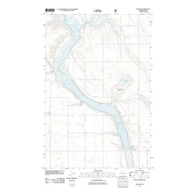
2011 Map of Jim Lake
USGS Topo · Published 2011About this map
The James River snakes through the center of this Stutsman County landscape, its course interrupted and widened by several water management structures. Small impoundments and natural basins define the local hydrography, including the prominent Jim Dam and the southern Depuy Dam, which forms Depuy Dam Lake. These water features serve as critical landmarks in a region dominated by a systematic grid of section roads like 80th Ave SE and 15th St SE.
Find a feature on this map
26 named features on this map. Tap any name to fly to it.
Don’t see what you’re looking for? This feature index may not catch every label — zoom into the map to look around manually.
Map Details
Editions of this 2011 Jim Lake Map
This is the sole edition of this map. No revisions or reprints were ever made.
Other maps of this area

1900 · Pingree
USGS Topo · 1:125,000

1900 · Pingree
USGS Topo · 1:62,500

1950 · Buchanan
USGS Topo · 1:24,000

1950 · Fried
USGS Topo · 1:24,000

1951 · Fried
USGS Topo · 1:24,000

1951 · Arrowwood Lake
USGS Topo · 1:24,000

1951 · Kensal
USGS Topo · 1:24,000

1951 · Pingree
USGS Topo · 1:24,000

1951 · Bordulac SW
USGS Topo · 1:24,000

1952 · Buchanan
USGS Topo · 1:24,000