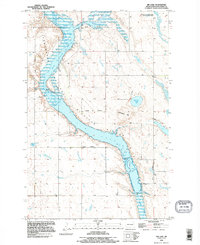
1990 Map of Jim Lake
USGS Topo · Published 1995About this map
Arrowwood National Wildlife Refuge dominates this section of the Jim River Valley, protecting a vast chain of wetlands along the James River. During the early 1990s, this landscape remained a critical corridor for migratory birds, characterized by the expansive waters of Jim Lake and the marshy reaches of Mud Lake. The topography is defined by the glacial legacy of the Grasshopper Hills, which rise above the river bottomlands to the east.
Find a feature on this map
12 named features on this map. Tap any name to fly to it.
Don’t see what you’re looking for? This feature index may not catch every label — zoom into the map to look around manually.
Map Details
Editions of this 1990 Jim Lake Map
This is the sole edition of this map. No revisions or reprints were ever made.
Other maps of this area

1900 · Pingree
USGS Topo · 1:125,000

1900 · Pingree
USGS Topo · 1:62,500

1950 · Buchanan
USGS Topo · 1:24,000

1950 · Fried
USGS Topo · 1:24,000

1951 · Fried
USGS Topo · 1:24,000

1951 · Arrowwood Lake
USGS Topo · 1:24,000

1951 · Kensal
USGS Topo · 1:24,000

1951 · Pingree
USGS Topo · 1:24,000

1951 · Bordulac SW
USGS Topo · 1:24,000

1952 · Buchanan
USGS Topo · 1:24,000