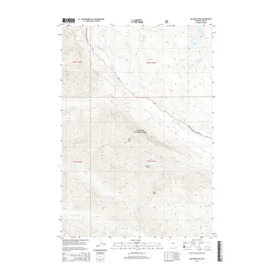
2015 Map of Jim Smith Peak
USGS Topo · Published 2015About this map
Jim Smith Peak and the high elevations of the Absaroka Range dominate this portion of the Shoshone National Forest in northwest Wyoming. The landscape is defined by its drainage systems, with the Clarks Fork Yellowstone River cutting a significant path through the terrain. The northern reaches are dotted with high-country water bodies including Big Moose Lake, the Crazy Lakes, and Little Moose Lake. Human passage through this wilderness is largely restricted to the Beartooth National Scenic Byway, which follows the river corridor. A complex network of named tributaries, such as Jim Smith Cr, Onemile Cr, and N Fork Crandall Cr, feeds the primary river, illustrating the hydrological character of the high Shoshone. The map also identifies local landmarks like Squaw Peak and several smaller streams including Crazy Cr and Tough Cr.
Find a feature on this map
24 named features on this map. Tap any name to fly to it.
Don’t see what you’re looking for? This feature index may not catch every label — zoom into the map to look around manually.
Map Details
Editions of this 2015 Jim Smith Peak Map
This is the sole edition of this map. No revisions or reprints were ever made.
Other maps of this area

1896 · Crandall Creek
USGS Topo · 1:125,000

1898 · Granite Mountain District
USGS Topo · 1:125,000

1899 · Crandall
USGS Topo · 1:125,000

1954 · Billings
USGS Topo · 1:250,000

1955 · Cody
USGS Topo · 1:250,000

1956 · Alpine
USGS Topo · 1:62,500

1956 · Beartooth Butte
USGS Topo · 1:62,500

1956 · Cooke City
USGS Topo · 1:62,500

1956 · Pilot Peak
USGS Topo · 1:62,500

1957 · Billings
USGS Topo · 1:250,000