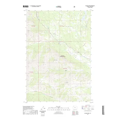
2021 Map of Jim Smith Peak
USGS Topo · Published 2021About this map
Jim Smith Peak and Squaw Peak dominate this high-elevation landscape within the Shoshone National Forest, where the jagged topography of the Beartooth Mountains meets the Absaroka Range. The Clarks Fork Yellowstone River carves a deep path through the center of the sheet, followed closely by the Beartooth National Scenic Byway and the historic route of the Old Cooke City Rd. This corridor represents a vital high-mountain passage, marked by the open area of Willow Park.
Find a feature on this map
30 named features on this map. Tap any name to fly to it.
Don’t see what you’re looking for? This feature index may not catch every label — zoom into the map to look around manually.
Map Details
Editions of this 2021 Jim Smith Peak Map
This is the sole edition of this map. No revisions or reprints were ever made.
Other maps of this area

1896 · Crandall Creek
USGS Topo · 1:125,000

1898 · Granite Mountain District
USGS Topo · 1:125,000

1899 · Crandall
USGS Topo · 1:125,000

1954 · Billings
USGS Topo · 1:250,000

1955 · Cody
USGS Topo · 1:250,000

1956 · Alpine
USGS Topo · 1:62,500

1956 · Beartooth Butte
USGS Topo · 1:62,500

1956 · Cooke City
USGS Topo · 1:62,500

1956 · Pilot Peak
USGS Topo · 1:62,500

1957 · Billings
USGS Topo · 1:250,000