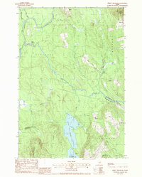
1988 Map of Jimmey Mountain
USGS Topo · Published 1988About this map
Mattawamkeag River and Baskahegan Stream dominate this northern Maine landscape, carving through a region defined by its expansive wetlands and ridges in the late 1980s. The map captures the small community at South Bancroft and the historically evocative Irish Settlement located near Snow Mtn. These remote outposts reflect the long-standing timber and agricultural heritage of Aroostook County and Washington County.
Find a feature on this map
43 named features on this map. Tap any name to fly to it.
Don’t see what you’re looking for? This feature index may not catch every label — zoom into the map to look around manually.
Map Details
Editions of this 1988 Jimmey Mountain Map
This is the sole edition of this map. No revisions or reprints were ever made.
Other maps of this area

1940 · Danforth
USGS Topo · 1:62,500

1940 · Amity
USGS Topo · 1:62,500

1941 · Danforth
USGS Topo · 1:62,500

1941 · Amity
USGS Topo · 1:62,500

1941 · Mattawamkeag Lake
USGS Topo · 1:62,500

1941 · Wytopitlock
USGS Topo · 1:62,500

1943 · Danforth
USGS Topo · 1:62,500

1943 · Wytopitlock
USGS Topo · 1:62,500

1943 · Amity
USGS Topo · 1:62,500

1943 · Mattawamkeag Lake
USGS Topo · 1:62,500