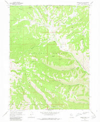
1967 Map of Jimmies Point
USGS Topo · Published 1980About this map
Uinta National Forest lands dominate this high-elevation landscape, where the waters of Currant Creek have carved a deep passage through The Narrows. At the time of this 1960s field check, the area served primarily as a managed wilderness and grazing resource, anchored by the Currant Creek Guard Sta in the north and a Cow Camp situated along the creek’s right fork.
Find a feature on this map
34 named features on this map. Tap any name to fly to it.
Don’t see what you’re looking for? This feature index may not catch every label — zoom into the map to look around manually.
Map Details
Editions of this 1967 Jimmies Point Map
3 editions found
Other maps of this area

1885 · Salt Lake
USGS Topo · 1:250,000

1885 · Uinta
USGS Topo · 1:250,000

1907 · Strawberry Valley
USGS Topo · 1:125,000

1909 · Strawberry Valley
USGS Topo · 1:125,000

1954 · Salt Lake City
USGS Topo · 1:250,000

1958 · Salt Lake City
USGS Topo · 1:250,000

1960 · Salt Lake City
USGS Topo · 1:250,000

1962 · Deep Creek Canyon
USGS Topo · 1:24,000
1962 · Wolf Creek
USGS Topo · 1:24,000

1962 · Raspberry Knoll
USGS Topo · 1:24,000