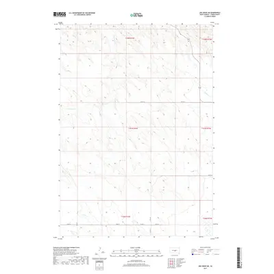
2017 Map of Joe Creek SW
USGS Topo · Published 2017About this map
S Fork Cedar Cr and Bad Horse Cr carve through the high plains of Lyman County, defining a landscape shaped by intermittent drainage and sparse infrastructure. This 2017 survey reveals the spatial organization of the modern ranching era, where wide-open rangeland is gridded by remote arteries such as Bia Rte 14 and Co Hwy 23. The southern reaches of the map are bisected by Co Rd 16 and 234th St, providing essential transit across the vast sections of the Public Land Survey System, including t107n r76w and t108n r75w. The course of Grouse Cr in the southwest corner highlights the natural water dependencies in this semi-arid region, where the terrain rises and falls between named creek beds that served as vital landmarks for generations of land users in central South Dakota.
Find a feature on this map
13 named features on this map. Tap any name to fly to it.
Don’t see what you’re looking for? This feature index may not catch every label — zoom into the map to look around manually.
Map Details
Editions of this 2017 Joe Creek SW Map
This is the sole edition of this map. No revisions or reprints were ever made.
Other maps of this area

1953 · Huron
USGS Topo · 1:250,000

1954 · Pierre
USGS Topo · 1:250,000

1954 · Huron
USGS Topo · 1:250,000

1955 · Martin
USGS Topo · 1:250,000

1955 · Mitchell
USGS Topo · 1:250,000

1958 · Pierre
USGS Topo · 1:250,000

1958 · Martin
USGS Topo · 1:250,000

1959 · Mitchell
USGS Topo · 1:250,000

1966 · Joe Creek
USGS Topo · 1:24,000

1966 · Ft. George Butte SE
USGS Topo · 1:24,000