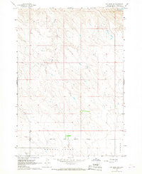
1966 Map of Joe Creek SW
USGS Topo · Published 1967About this map
The Lower Brule Indian Reservation Boundary stretches across the southern portion of this mid-1960s landscape, marking the transition between tribal lands and the surrounding Lyman County terrain. This survey reflects a significant period for the Missouri River basin, following the creation of Lake Sharpe, which appears here at its normal operating pool elevation. The topography is defined by the drainage systems of the South Fork Cedar Creek and Grouse Creek, showing the complex network of draws and ridges that characterize the region. While the area is largely undeveloped, the presence of Dorman in the southeast corner and the specific reservation boundary lines offer critical reference points for understanding historical land tenure and tribal geography in central South Dakota.
Find a feature on this map
5 named features on this map. Tap any name to fly to it.
Don’t see what you’re looking for? This feature index may not catch every label — zoom into the map to look around manually.
Map Details
Editions of this 1966 Joe Creek SW Map
This is the sole edition of this map. No revisions or reprints were ever made.
Other maps of this area

1953 · Huron
USGS Topo · 1:250,000

1954 · Pierre
USGS Topo · 1:250,000

1954 · Huron
USGS Topo · 1:250,000

1955 · Martin
USGS Topo · 1:250,000

1955 · Mitchell
USGS Topo · 1:250,000

1958 · Pierre
USGS Topo · 1:250,000

1958 · Martin
USGS Topo · 1:250,000

1959 · Mitchell
USGS Topo · 1:250,000

1966 · Joe Creek
USGS Topo · 1:24,000

1966 · Ft. George Butte SE
USGS Topo · 1:24,000