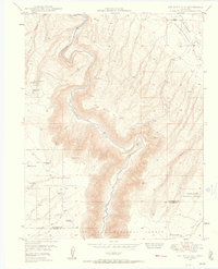
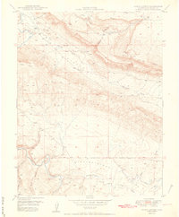
1949 Map of Joe Davis Hill
USGS Topo · Published 1957About this map
Mining operations for the United States Atomic Energy Commission define this high-desert landscape during the early Cold War uranium boom. The Dolores River cuts a deep path through the center of the sheet, flanked by the steep slopes of Joe Davis Hill and the dramatic topography of Blue Canyon. Local resource extraction is evident at the Norma Jean Mine and Spud Patch Camp, while more remote claims like the Sarah Ellen Mine and Mucho Grande Mine appear across the rugged terrain. To the south and west, the map details the boundaries of the Uncompahgre National Forest and San Juan National Forest, where water management features like Sand Rock Reservoir and Sawmill Spring supported land use near the San Miguel and Dolores County line. The northeastern corner transitions into the open expanse of Disappointment Valley, illustrating the varied geological character of this Colorado backcountry.
Find a feature on this map
30 named features on this map. Tap any name to fly to it.
Don’t see what you’re looking for? This feature index may not catch every label — zoom into the map to look around manually.
Map Details
Editions of this 1949 Joe Davis Hill Map
5 editions found
Other maps of this area

1916 · Paradox Valley
USGS Topo · 1:125,000

1922 · Paradox Valley
USGS Topo · 1:125,000

1948 · Horse Range Mesa
USGS Topo · 1:24,000

1948 · Hamm Canyon
USGS Topo · 1:24,000

1948 · Gypsum Gap
USGS Topo · 1:24,000

1949 · Gypsum Gap
USGS Topo · 1:24,000

1949 · Egnar
USGS Topo · 1:24,000

1949 · Joe Davis Hill
USGS Topo · 1:24,000

1950 · Horse Range Mesa
USGS Topo · 1:24,000
1950 · Hamm Canyon
USGS Topo · 1:24,000