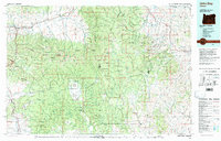
1978 Map of John Day
USGS Topo · Published 1997About this map
John Day and the nearby gold-mining hub of Canyon City anchor this 1970s landscape, reflecting a region defined by high-elevation valleys and federal timberlands. The survey documents the expansive reach of the Malheur National Forest and Whitman National Forest, where resource extraction is visible through several named operations such as the Celebration Mine, Ray Mine, and the Bardy Mountain Mine.
Find a feature on this map
46 named features on this map. Tap any name to fly to it.
Don’t see what you’re looking for? This feature index may not catch every label — zoom into the map to look around manually.
Map Details
Editions of this 1978 John Day Map
2 editions found

Other maps of this area

1901 · Baker City
USGS Topo · 1:125,000

1901 · Sumpter
USGS Topo · 1:125,000

1908 · Ironside Mountain
USGS Topo · 1:125,000

1940 · Mount Vernon
USGS Topo · 1:62,500

1940 · John Day
USGS Topo · 1:62,500

1943 · John Day
USGS Topo · 1:62,500

1943 · Mount Vernon
USGS Topo · 1:62,500

1949 · Long Creek
USGS Topo · 1:62,500

1949 · Susanville
USGS Topo · 1:62,500

1951 · Susanville
USGS Topo · 1:62,500