Old Maps of Harney County, Oregon
Explore 1,218 old maps of Harney County, spanning from 1886 to today. These high-resolution historic maps reveal how streets, neighborhoods, landmarks, and natural features evolved over time — perfect for genealogy, metal detecting, research, and local history exploration.
What you can do with these maps:
- See how Harney County changed over time: Compare historical maps to modern-day views to trace roads, homesites, rail lines & more.
- View detailed metadata: Each map includes creators, publishers, year, scale, and archive source.
- Overlay maps with satellite & LiDAR: Visualize the past alongside modern tools to explore terrain & human change.
- Trusted historical sources: Maps sourced from the USGS, Library of Congress, and other archives.
- Access maps your way: View online, download high-res files, or order prints for personal or research use.
Start exploring old maps of Harney County to uncover forgotten places, hidden landmarks, and the deep history beneath your feet.
Harney County, OR maps
(1,218)- 1886 Map of Disaster
 1886 Disaster1886 Print · USGSHumboldt County in the late nineteenth century was a rugged frontier of thermal springs and isolated mountain passes. Researchers can trace early routes through Thacker Pass, locate the settlement at Mason's Crossing, and identify watering points like Pahute Meadows.
 - 1889 Map of Long Valley
 1889 Long Valley1889 Print · USGSNorthwestern Nevada was a land of high desert springs and remote outposts in the late nineteenth century. Researchers can trace the legacy of early military presence at Camp McGarry or locate crucial water sources like Massacre Lakes and Soldier Meadows.
 - 1893 Map of Disaster
 1893 Disaster1893 Print · USGSHumboldt County's high desert reaches were a land of isolated crossings and thermal springs in the late nineteenth century. Researchers can trace the path through Thacker Pass and locate early sites like Mason's Crossing or Pahute Meadows.5 unique versions available
 - 1908 Map of Ironside Mountain
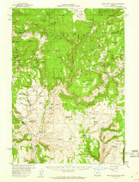
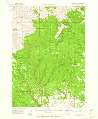
 1908 Ironside Mountain1908 Print · USGSEastern Oregon ranching and timber frontiers come alive in this survey of the Blue Mountains region at the turn of the century. Researchers can trace early family holdings like Tureman's Ranch and Hunter's Ranch, or locate the historic Otis Sawmill.2 unique versions available
 - 1954 Map of Vya, 1967 Print
 1954 Vya1967 Print · USGSThe tri-state corner of Nevada, Oregon, and California appears here in the mid-fifties, dominated by wildlife refuges and massive naval gunnery ranges. Trace isolated high-desert outposts like Vya and Soldier Meadow Ranch or find historic workings at the Ashdown Mine.3 unique versions available
 - 1955 Map of Burns, 1964 Print
 1955 Burns1964 Print · USGSHarney County's high desert ranching and timber heartland is captured here in the mid-fifties, centered on the hub of Burns and Hines. Genealogists and researchers can locate remote landmarks like the Suntex School, New Princeton P. O., and the Lumber Mill.3 unique versions available
 - 1955 Map of Canyon City, 1966 Print
 1955 Canyon City1966 Print · USGSCentral Oregon's high desert and timber country are captured here in the mid-fifties, showing the rugged ranching and logging landscape. Trace the path of the Sumpter Valley Ry or locate remote settlements like Izee, Whitney, and Ritter.4 unique versions available
 - 1955 Map of Adel, 1971 Print
 1955 Adel1971 Print · USGSSoutheast Oregon in the mid-fifties remains a landscape of vast alkaline basins and high mountain scarps, anchored by remote outposts. Researchers can trace historic ranching routes through Catlow Valley and locate landmarks like Beatys Butte or the small settlement of Blitzen.2 unique versions available
 - 1957 Map of Adel
 1957 Adel1957 Print · USGSSoutheast Oregon in the mid-fifties reveals a high-desert landscape of sprawling ranches and vast wildlife refuges before modern development. Genealogists and researchers can trace the remote outposts of the region, from the Red Point School to historic headquarters like the Guano Ranch and Frenchglen.
 - 1958 Map of Burns
 1958 Burns1958 Print · USGSHarney County ranching and timber lands are captured here in the late fifties. Genealogists and local historians can trace family holdings and rural institutions, from the Kimball Flat School to remote outposts like Crow Camp Ranch and the Sutton Ranch.
 - 1958 Map of Vya
 1958 Vya1958 Print · USGSNorthwest Nevada and the tri-state border region are mapped here during the mid-fifties, showing a remote landscape of high desert ranches and sprawling antelope range. Trace historic operations like the Ashdown Mine, find local camps like Coyote Camp, and locate isolated outposts from Vya to Denio.2 unique versions available
 - 1958 Map of Adel
 1958 Adel1958 Print · USGSSoutheastern Oregon in the mid-fifties is captured here, showing a vast territory of high desert basins and isolated ranching outposts. Genealogists and researchers can trace the locations of the Red Point School, Frenchglen, and remote sites like Guano Ranch.2 unique versions available
 - 1959 Map of Burns
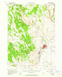
 1959 Burns1959 Print · USGSHarney County in the late fifties remains a landscape of high-desert ranching and timber production, centered on the hubs of Burns and Hines. Researchers can locate remote rural institutions like the Suntex School or trace family landholdings such as the Stallard Ranch and O'Keefe Homestead.
 - 1959 Map of Canyon City
 1959 Canyon City1959 Print · USGSEastern Oregon in the late fifties was a landscape of high timber and remote river valleys shaped by the cattle and mining trades. Genealogists and historians can trace the paths of the Sumpter Valley RR and find early settlements like Antone, Richmond, and Dayville.2 unique versions available
 - 1959 Map of West Myrtle Butte, 1960 Print
 1959 West Myrtle Butte1960 Print · USGSHigh-elevation ranching and timberlands define this Oregon backcountry during the late fifties, where the Malheur National Forest spans the county line. Genealogists and historians can locate early family outposts like the Old Dole Smith Homestead, Peabody Homestead, and Bassuot Cabin.2 unique versions available
 - 1959 Map of Sawtooth Creek, 1960 Print
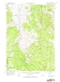
 1959 Sawtooth Creek1960 Print · USGSHigh desert rangeland and timber country come to life in this late 1950s survey of the Grant and Harney County line. Researchers can trace remote ranching history at the Ramsey Ranch and Rickman Ranch or locate forest service landmarks like the Snow Mtn Lookout.2 unique versions available
 - 1959 Map of Harney, 1961 Print
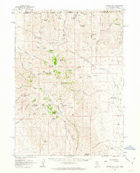
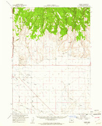 1959 Harney1961 Print · USGSThe Harney County high desert and forest transition are captured here in the late fifties, showing the area's vital water and rail infrastructure. Researchers can locate the Fort Harney (Site), trace the Union Pacific railroad, and find small locales like Gradon and Harney.2 unique versions available
 - 1959 Map of Dog Mountain, 1961 Print
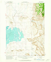
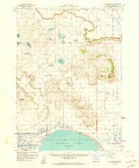 1959 Dog Mountain1961 Print · USGSThe high desert of Harney County comes into focus in the late fifties, showcasing a vast basin and range landscape before modern development. Researchers can trace the water levels of Harney Lake and locate remote landmarks like Frank Schmidt Lake or the Savage Grade Jeep Trail.2 unique versions available
 - 1959 Map of Lawen, 1961 Print
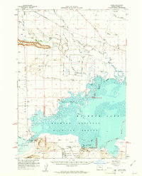 1959 Lawen1961 Print · USGSHarney County's high desert wetlands are preserved here during the late fifties, showing the complex hydrology of the Malheur Lake basin. Researchers can locate the historic Sod House School, the Lawen settlement along the Union Pacific railroad, and the Sod House Dam.
 - 1960 Map of Crane, 1962 Print
 1960 Crane1962 Print · USGSHarney County's high desert landscape comes alive in the early sixties, showing the vital relationship between the Union Pacific rail line and the vast Malheur Lake basin. Genealogists and historians can trace the foundations of Crane and New Princeton, while locating landmarks like Kruger Field and the Hot Springs.2 unique versions available
 - 1960 Map of Burns, 1962 Print
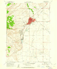
 1960 Burns1962 Print · USGSHarney County's high desert hubs and surrounding cattle country are captured here just as the postwar era matured. Genealogists and local historians can locate family landmarks like the Peterson Ranch, trace the Northwestern Pacific rail line, or find early civic sites like the Union High Sch.
 - 1960 Map of Burns, 1962 Print
 1960 Burns1962 Print · USGSThe Harney Basin communities of Burns and Hines are shown here in the early sixties at a peak of rail-driven and agricultural activity. Researchers can trace family history at the Burns Piute Cemetery or locate civic landmarks like the Grange Hall and the Experimental Station.2 unique versions available
 - 1961 Map of Delintment Lake, 1962 Print
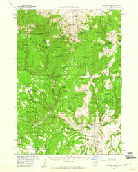
 1961 Delintment Lake1962 Print · USGSHigh in the Ochoco Mountains during the early sixties, this area centered on Delintment Lake was a hub for forest management and back-country recreation. Researchers can locate remote sites like the Buck Spring Guard Sta, trace trails past Donnelly Butte, and find family-named landmarks like Williams Reservoir.2 unique versions available
 - 1961 Map of Calamity Butte, 1963 Print
 1961 Calamity Butte1963 Print · USGSHarney County's timber and mining country is captured here during the early sixties, featuring the working line of the Oregon and Northwestern Railroad. Genealogists and historians can trace the foundations of Idol City, the Lowe Mill site, and the remote Call Meadow Guard Sta.
 - 1961 Map of Trident Peak, 1963 Print
 1961 Trident Peak1963 Print · USGSThe Nevada-Oregon borderlands appear as a rugged ranching and mining frontier in the early sixties. Researchers can trace remote habitations and early industry at the Lucky Strike Mine, Kings River Ranch, and the Jack Spade Cabin ruins.2 unique versions available
Showing maps 1-25 of 1,218
Top cities of Harney County
Frequently asked questions
- What are the different types of historical maps available for Harney County?
- What is the oldest map of Harney County?
- Where can I purchase historical maps of Harney County for my home or office?
- Where can I download high-res historical maps of Harney County?
- Are there historical topographic maps available for Harney County?
- Is there historical aerial imagery available for Harney County?
- Where are historical maps of Harney County sourced from?