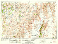
1958 Map of Vya
USGS Topo · Published 1958About this map
Sheldon National Antelope Refuge dominates the northwestern corner of this landscape, where the high desert terrain of the Charles Sheldon Antelope Range meets the Guano Valley. This mid-century survey reveals a territory defined by isolated ranches and mineral extraction, with the U S Naval Gunnery Range occupying a significant portion of the Black Rock Desert. Local industry is evidenced by specialized operations like the Rainbow Ridge Opal Mine and several gold and silver prospects, including the Antelope Mine and Cherry Gulch Mine. Transport through this sparse region relies on State Hwy 8A and State Hwy 34, connecting remote outposts such as Vya and Denio. The map captures a high-desert economy reliant on vast grazing lands, as seen in the numerous family-named landmarks like Duffurena Ranch and Quinn River Crossing Ranch.
Find a feature on this map
152 named features on this map. Tap any name to fly to it.
Don’t see what you’re looking for? This feature index may not catch every label — zoom into the map to look around manually.
Map Details
Editions of this 1958 Vya Map
2 editions found

Other maps of this area

1882 · Paradise
USGS Topo · 1:250,000

1886 · Alturas
USGS Topo · 1:250,000

1886 · Honey Lake
USGS Topo · 1:250,000

1886 · Disaster
USGS Topo · 1:250,000

1886 · Granite Range
USGS Topo · 1:250,000

1889 · Long Valley
USGS Topo · 1:250,000

1891 · Honey Lake
USGS Topo · 1:250,000

1892 · Alturas
USGS Topo · 1:250,000

1893 · Paradise
USGS Topo · 1:250,000

1893 · Honey Lake
USGS Topo · 1:250,000