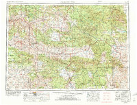
1955 Map of Canyon City
USGS Topo · Published 1972About this map
The John Day River and its multiple forks define the rugged landscape of Central Oregon, carving through high plateaus and ancient geological formations. This mid-century survey captures the region's vast network of federal lands, including the Umatilla National Forest, Malheur National Forest, and Ochocco National Forest. The geography is anchored by significant mountain ranges like the Strawberry Mountains and Blue Mountains, where high peaks like Dixie Butte and Lookout Mountain watch over a territory of timber and livestock ranching.
Find a feature on this map
124 named features on this map. Tap any name to fly to it.
Don’t see what you’re looking for? This feature index may not catch every label — zoom into the map to look around manually.
Map Details
Editions of this 1955 Canyon City Map
4 editions found

Other maps of this area

1901 · Baker City
USGS Topo · 1:125,000

1901 · Sumpter
USGS Topo · 1:125,000

1906 · Telocaset
USGS Topo · 1:125,000

1908 · Ironside Mountain
USGS Topo · 1:125,000

1916 · Condon
USGS Topo · 1:125,000

1926 · Mitchell
USGS Topo · 1:125,000

1932 · Dayville
USGS Topo · 1:125,000

1936 · Dayville
USGS Topo · 1:125,000

1940 · Mount Vernon
USGS Topo · 1:62,500

1940 · Aldrich Mtn.
USGS Topo · 1:62,500