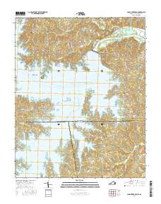
2016 Map of John H Kerr Dam
USGS Topo · Published 2016About this map
The John H Kerr Dam stands as the central engineering feature of this borderland region, impounding the Roanoke River to create the expansive John H. Kerr Reservoir. This landscape is defined by the intricate, flooded fingers of the reservoir that reach into both Virginia and North Carolina, creating a complex shoreline that surrounds Keats Peninsula and islands like Buggs Island and Gilligans Island. On the northern shore, the community of Castle Heights and the settlement at Phillis sit above the dam, while downstream to the east, the river flows into Lake Gaston.
Find a feature on this map
72 named features on this map. Tap any name to fly to it.
Don’t see what you’re looking for? This feature index may not catch every label — zoom into the map to look around manually.
Map Details
Editions of this 2016 John H Kerr Dam Map
This is the sole edition of this map. No revisions or reprints were ever made.
Other maps of this area

1953 · Greensboro
USGS Topo · 1:250,000

1954 · Greensboro
USGS Topo · 1:250,000

1955 · Boydton
USGS Topo · 1:62,500

1962 · Greensboro
USGS Topo · 1:250,000

1966 · Greensboro
USGS Topo · 1:250,000

1968 · Bracey
USGS Topo · 1:24,000
1968 · Tungsten
USGS Topo · 1:24,000

1968 · John H Kerr Dam
USGS Topo · 1:24,000
1968 · Boydton
USGS Topo · 1:24,000
1968 · Baskerville
USGS Topo · 1:24,000