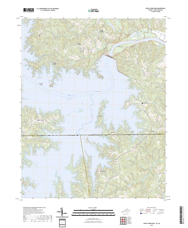
2022 Map of John H Kerr Dam
USGS Topo · Published 2022About this map
The vast expanse of the John H. Kerr Reservoir dominates this landscape along the Virginia and North Carolina border, where the flooded valleys of Kettles Cr and Robbins Cr create an intricate shoreline of peninsulas and islands. High ground near the Buggs Island dam supports established communities like Castle Heights and Phillis, while the eastern portion of the map shows the upper reaches of Lake Gaston. The geography is defined by its water-access points, with labels like Keats Peninsula and Eppes Fork marking the recreational and residential fingerprints of the mid-20th-century reservoir project. Local history is anchored by rural landmarks such as Shiloh Cem and Union Chapel Cem, while the Tobacco Heritage Trl follows the historical corridor north of the reservoir, reflecting the region's agricultural past.
Find a feature on this map
77 named features on this map. Tap any name to fly to it.
Don’t see what you’re looking for? This feature index may not catch every label — zoom into the map to look around manually.
Map Details
Editions of this 2022 John H Kerr Dam Map
This is the sole edition of this map. No revisions or reprints were ever made.
Other maps of this area

1953 · Greensboro
USGS Topo · 1:250,000

1954 · Greensboro
USGS Topo · 1:250,000

1955 · Boydton
USGS Topo · 1:62,500

1962 · Greensboro
USGS Topo · 1:250,000

1966 · Greensboro
USGS Topo · 1:250,000

1968 · Bracey
USGS Topo · 1:24,000
1968 · Tungsten
USGS Topo · 1:24,000

1968 · John H Kerr Dam
USGS Topo · 1:24,000
1968 · Boydton
USGS Topo · 1:24,000
1968 · Baskerville
USGS Topo · 1:24,000