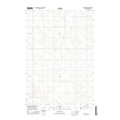
2017 Map of Johnnie Creek
USGS Topo · Published 2017About this map
Mizpah Cr serves as the primary drainage through this expanse of Powder River County, where a network of tributary streams creates a complex hydrologic pattern across the territory. The landscape is defined by its intermittent waterways, including Johnnie Creek and Lost Soldier Creek, which carve through the terrain south of the Hay Creek Rd corridor. This 2017 survey reflects a remote ranching landscape where historical land divisions like t1s r51e are traversed by vital local arteries such as Mizpah Rd. The scarcity of structural development emphasizes the persistence of traditional land use in this part of Montana, where named features like Mud Spring Creek and Alkali Creek provide the essential geographic markers for residents and researchers of the high plains.
Find a feature on this map
18 named features on this map. Tap any name to fly to it.
Don’t see what you’re looking for? This feature index may not catch every label — zoom into the map to look around manually.
Map Details
Editions of this 2017 Johnnie Creek Map
This is the sole edition of this map. No revisions or reprints were ever made.
Other maps of this area

1954 · Ekalaka
USGS Topo · 1:250,000

1956 · Ekalaka
USGS Topo · 1:250,000

1958 · Ekalaka
USGS Topo · 1:250,000

1965 · Ekalaka
USGS Topo · 1:250,000

1973 · Olive
USGS Topo · 1:24,000

1973 · Cross S School
USGS Topo · 1:24,000
1973 · Witcher Reservoir
USGS Topo · 1:24,000

1973 · Moonlight Creek
USGS Topo · 1:24,000

1973 · Coalwood
USGS Topo · 1:24,000
1973 · Rattlesnake Hill
USGS Topo · 1:24,000