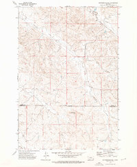
1973 Map of Rattlesnake Hill
USGS Topo · Published 1976About this map
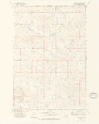
The boundary between Custer and Powder River counties divides this high plains landscape, centered on the prominent elevation of Rattlesnake Hill. Mapping from the early 1970s reveals a sparsely settled ranching territory defined by intermittent drainage systems such as Little Corral Creek, Horse Creek, and Cross Creek. Human presence is marked by essential water infrastructure, including several scattered wells and a spring, alongside a series of fence lines that trace the section boundaries of the public land survey system. The topography is further anchored by the east-west orientation of the Base Line, a fundamental surveying reference for the region. This document captures the remote character of Montana's southeastern rangelands before significant modern development, emphasizing the relationship between limited water resources and the vast livestock grazing tracts of the era.
Find a feature on this map
10 named features on this map. Tap any name to fly to it.
Don’t see what you’re looking for? This feature index may not catch every label — zoom into the map to look around manually.
Map Details
Editions of this 1973 Rattlesnake Hill Map
This is the sole edition of this map. No revisions or reprints were ever made.
Other maps of this area

1954 · Ekalaka
USGS Topo · 1:250,000

1956 · Ekalaka
USGS Topo · 1:250,000

1958 · Ekalaka
USGS Topo · 1:250,000

1965 · Ekalaka
USGS Topo · 1:250,000
1973 · Saddle Horse Butte
USGS Topo · 1:24,000
1973 · Maxwell Butte
USGS Topo · 1:24,000

1973 · Cross S School
USGS Topo · 1:24,000
1973 · Witcher Reservoir
USGS Topo · 1:24,000
1973 · Johnnie Creek
USGS Topo · 1:24,000
1979 · Mills Creek West
USGS Topo · 1:24,000