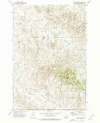
1973 Map of Maxwell Butte
USGS Topo · Published 1976About this map
Maxwell Butte rises as a prominent landmark in this Custer County landscape, overlooking a network of seasonal drainages and early infrastructure. The map documents a sparsely populated ranching or resource extraction area during the early 1970s, characterized by isolated water sources like Well and Spring sites that were vital for sustaining activity in this arid terrain. The Powderville Road serves as the primary artery through the southern portion of the quadrangle, linking the remote territory to larger regional hubs.
Find a feature on this map
9 named features on this map. Tap any name to fly to it.
Don’t see what you’re looking for? This feature index may not catch every label — zoom into the map to look around manually.
Map Details
Editions of this 1973 Maxwell Butte Map
This is the sole edition of this map. No revisions or reprints were ever made.
Other maps of this area

1953 · Miles City
USGS Topo · 1:250,000

1954 · Ekalaka
USGS Topo · 1:250,000

1956 · Ekalaka
USGS Topo · 1:250,000

1957 · Miles City
USGS Topo · 1:250,000

1958 · Miles City
USGS Topo · 1:250,000

1958 · Ekalaka
USGS Topo · 1:250,000

1965 · Ekalaka
USGS Topo · 1:250,000

1969 · Forty Creek
USGS Topo · 1:24,000

1969 · Miles City Creek
USGS Topo · 1:24,000
1969 · Bear Jaw Creek
USGS Topo · 1:24,000