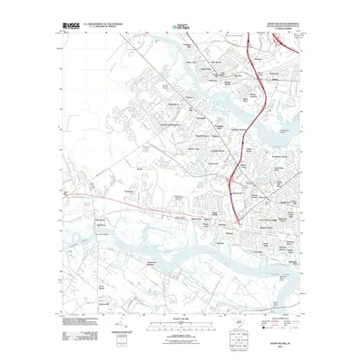
2011 Map of Johns Island
USGS Topo · Published 2011About this map
Drayton Hall and Hickory Hall Plantation anchor the landscape along the Ashley River, reflecting the long-standing agricultural and residential history of this Lowcountry corridor. The 2011 survey reveals an area defined by its complex waterways, where the Stono River meets the Intracoastal Waterway near the Limehouse Bridge. The transition from rural acreage to suburban development is evident in the numerous named subdivisions like Wando Woods, Greenwood Park, and Shadowmoss that have filled the space between historic sites.
Find a feature on this map
158 named features on this map. Tap any name to fly to it.
Don’t see what you’re looking for? This feature index may not catch every label — zoom into the map to look around manually.
Map Details
Editions of this 2011 Johns Island Map
This is the sole edition of this map. No revisions or reprints were ever made.
Other maps of this area

1919 · Ladson
USGS Topo · 1:21,120

1919 · Johns Island
USGS Topo · 1:21,120

1919 · Wadmelaw Island
USGS Topo · 1:62,500

1919 · Melgrove
USGS Topo · 1:21,120

1919 · Charleston
USGS Topo · 1:21,120

1919 · James Island
USGS Topo · 1:21,120

1919 · Legareville
USGS Topo · 1:21,120

1920 · Ravenels
USGS Topo · 1:62,500

1940 · Melgrove
USGS Topo · 1:24,000

1943 · Legareville
USGS Topo · 1:24,000
Featured Places
- Charleston, SC
- North Charleston, SC
- Hollywood, SC
- Brentwood, North Charleston
- Ashley Villas, North Charleston