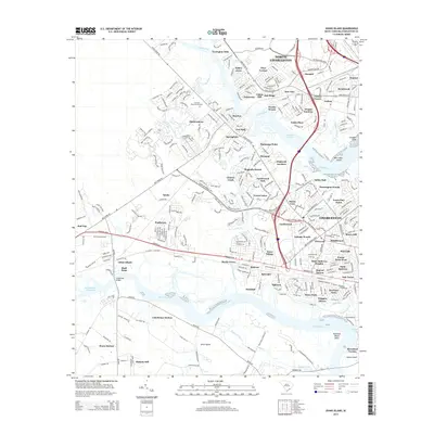
2014 Map of Johns Island
USGS Topo · Published 2014About this map
The Stono River and Ashley River frame the intricate tidal landscape of Charleston County, where modern suburban development meets historic lowcountry waterways. Dense residential clusters such as North Charleston, Pierpont, and Wando Woods are established along the riverbanks, illustrating the transition from agricultural tracts to structured neighborhoods. Significant land use is marked by the Live Oak Memorial Gardens and the expansive reaches of Bulls Creek, which wind through the marshy terrain before joining the Intracoastal Waterway. The presence of Drayton and Ashley Hall highlights the enduring placement of community centers near the river corridors. Navigational arteries like Savannah Hwy and Bees Ferry Rd connect these settlements, providing a clear view of the region's transport network as it appeared in 2014.
Find a feature on this map
84 named features on this map. Tap any name to fly to it.
Don’t see what you’re looking for? This feature index may not catch every label — zoom into the map to look around manually.
Map Details
Editions of this 2014 Johns Island Map
This is the sole edition of this map. No revisions or reprints were ever made.
Other maps of this area

1919 · Ladson
USGS Topo · 1:21,120

1919 · Johns Island
USGS Topo · 1:21,120

1919 · Wadmelaw Island
USGS Topo · 1:62,500

1919 · Melgrove
USGS Topo · 1:21,120

1919 · Charleston
USGS Topo · 1:21,120

1919 · James Island
USGS Topo · 1:21,120

1919 · Legareville
USGS Topo · 1:21,120

1920 · Ravenels
USGS Topo · 1:62,500

1940 · Melgrove
USGS Topo · 1:24,000

1943 · Legareville
USGS Topo · 1:24,000
Featured Places
- Charleston, SC
- North Charleston, SC
- Hollywood, SC
- Brentwood, North Charleston
- Ashley Villas, North Charleston