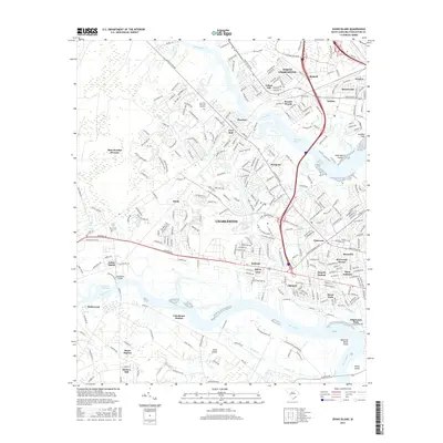
2017 Map of Johns Island
USGS Topo · Published 2017About this map
The Ashley River and Stono River define this coastal landscape near the junction of North Charleston and the sea islands during the late 2010s. This survey documents the densely packed residential expansion across Johns Island and the mainland, where suburban neighborhoods like Wando Woods and Sherwood Forest meet tidal marshes and historical sites. The influence of the Intracoastal Waterway is evident through significant engineering features like the Limehouse Bridge and Elliott Cut, which facilitate navigation through the lowcountry terrain. Smaller waterways such as Bulls Cr and Macbeth Cr weave between established communities, including Drayton and Maryville. The map also captures several transit-related landmarks from the area's development, including Dupont Station and Stono Station, alongside the sprawling grounds of Live Oak Memorial Gardens. To the northwest, the protected wetlands of the Bear Swamp Division provide a sharp contrast to the industrial and commercial corridors of North Charleston.
Find a feature on this map
300 named features on this map. Tap any name to fly to it.
Don’t see what you’re looking for? This feature index may not catch every label — zoom into the map to look around manually.
Map Details
Editions of this 2017 Johns Island Map
This is the sole edition of this map. No revisions or reprints were ever made.
Other maps of this area

1919 · Ladson
USGS Topo · 1:21,120

1919 · Johns Island
USGS Topo · 1:21,120

1919 · Wadmelaw Island
USGS Topo · 1:62,500

1919 · Melgrove
USGS Topo · 1:21,120

1919 · Charleston
USGS Topo · 1:21,120

1919 · James Island
USGS Topo · 1:21,120

1919 · Legareville
USGS Topo · 1:21,120

1920 · Ravenels
USGS Topo · 1:62,500

1940 · Melgrove
USGS Topo · 1:24,000

1943 · Legareville
USGS Topo · 1:24,000
Featured Places
- Charleston, SC
- North Charleston, SC
- Hollywood, SC
- Brentwood, North Charleston
- Ashley Villas, North Charleston