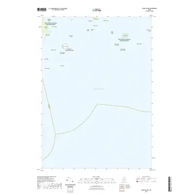
2021 Map of Johns Island
USGS Topo · Published 2021About this map
Johns Island and a series of rugged granite outposts define this coastal survey of the Atlantic Ocean south of Swan's Island. The landscape is characterized by protected lands and hazardous maritime features, with portions of the Petit Manan National Wildlife Refuge and Acadia National Park spanning several islands. This contemporary study illustrates the intricate bathymetry and topography of a remote Maine archipelago, where high points like Devils Head on Marshall Island rise above protected coves and treacherous shallows.
Find a feature on this map
30 named features on this map. Tap any name to fly to it.
Don’t see what you’re looking for? This feature index may not catch every label — zoom into the map to look around manually.
Map Details
Editions of this 2021 Johns Island Map
This is the sole edition of this map. No revisions or reprints were ever made.
Other maps of this area

1904 · Deer Isle
USGS Topo · 1:62,500

1904 · Swan Island
USGS Topo · 1:62,500

1905 · Penobscot Bay
USGS Topo · 1:125,000

1942 · Deer Isle
USGS Topo · 1:62,500

1943 · Swans Island
USGS Topo · 1:62,500

1944 · Deer Isle
USGS Topo · 1:62,500

1945 · Swans Island
USGS Topo · 1:62,500

1948 · Bangor
USGS Topo · 1:250,000

1948 · Bath
USGS Topo · 1:250,000

1956 · Bangor
USGS Topo · 1:250,000