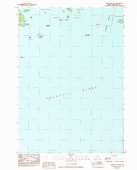
1983 Map of Johns Island
USGS Topo · Published 1983About this map
Johns I sits at the heart of this coastal Maine survey, surrounded by the rocky outcroppings and scattered archipelagos of the Southwest Approach. The landscape is defined by the proximity of Acadia National Park on Heron I, emphasizing the preserved and maritime character of Hancock County in the early 1980s. To the northwest, Marshall Island features distinct coastal formations like Pobblestone Cove and Devils Head, while the waters of Toothacher Bay separate it from the larger landmass of Swans Island. The eastern edge of the map includes portions of Frenchboro on Long I, where Steamboat Beach provides a named landmark along the Atlantic shoreline. This maritime network of ledges, rocks, and small islands illustrates the intricate navigational hazards and small-scale geographic features vital to local sailors and coastal history researchers.
Find a feature on this map
28 named features on this map. Tap any name to fly to it.
Don’t see what you’re looking for? This feature index may not catch every label — zoom into the map to look around manually.
Map Details
Editions of this 1983 Johns Island Map
This is the sole edition of this map. No revisions or reprints were ever made.
Other maps of this area

1904 · Deer Isle
USGS Topo · 1:62,500

1904 · Swan Island
USGS Topo · 1:62,500

1905 · Penobscot Bay
USGS Topo · 1:125,000

1942 · Deer Isle
USGS Topo · 1:62,500

1943 · Swans Island
USGS Topo · 1:62,500

1944 · Deer Isle
USGS Topo · 1:62,500

1945 · Swans Island
USGS Topo · 1:62,500

1948 · Bangor
USGS Topo · 1:250,000

1948 · Bath
USGS Topo · 1:250,000

1956 · Bangor
USGS Topo · 1:250,000