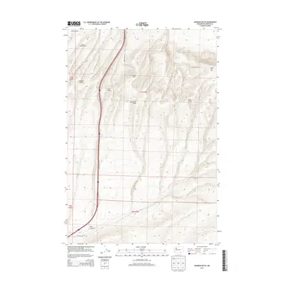
2013 Map of Johnson Butte
USGS Topo · Published 2013About this map
The Horse Heaven Hills dominate this portion of Benton County, where the high ridges of the Columbia Plateau descend toward the Walla Walla Valley. This modern survey reveals a landscape primarily defined by its physical relief, featuring prominent elevations like Johnson Butte and the curiously named Jump Off Joe. The terrain is deeply incised by a series of drainages, including Amon Canyon, Prospect Canyon, and Zintel Canyon, which carve through the basaltic uplands.
Find a feature on this map
16 named features on this map. Tap any name to fly to it.
Don’t see what you’re looking for? This feature index may not catch every label — zoom into the map to look around manually.
Map Details
Editions of this 2013 Johnson Butte Map
This is the sole edition of this map. No revisions or reprints were ever made.
Other maps of this area

1908 · Umatilla
USGS Topo · 1:125,000

1917 · Pasco
USGS Topo · 1:125,000

1953 · Pendleton
USGS Topo · 1:250,000

1953 · Walla Walla
USGS Topo · 1:250,000

1956 · Pendleton
USGS Topo · 1:250,000

1958 · Walla Walla
USGS Topo · 1:250,000

1962 · Hat Rock
USGS Topo · 1:24,000

1962 · Juniper
USGS Topo · 1:24,000

1962 · Umatilla
USGS Topo · 1:24,000
1964 · Johnson Butte
USGS Topo · 1:24,000