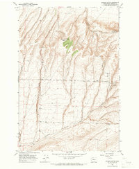
1964 Map of Johnson Butte
USGS Topo · Published 1966About this map
Johnson Butte rises as the central landmark of this mid-1960s landscape in Benton County, a terrain defined by deep incisions like Zintel Canyon and Prospect Canyon. This era shows a transition toward modern infrastructure, featuring the Radio Tower (KEPR) and Radio Towers at Jump Off Joe, emphasizing the importance of high-altitude landmarks for regional communication. The agricultural and logistical network is visible through the system of roads such as Beck Road and Coffin Road, connecting water sources like Bofer Well and Cresswell Well. The presence of a pipeline and a Storage Bin suggests an economy geared toward resource management and dry-land farming. The topography is meticulously detailed, showing the complex drainage patterns of Fourmile Canyon and Owens Canyon, providing a clear view of the Washington interior before significant modern expansion.
Find a feature on this map
21 named features on this map. Tap any name to fly to it.
Don’t see what you’re looking for? This feature index may not catch every label — zoom into the map to look around manually.
Map Details
Editions of this 1964 Johnson Butte Map
2 editions found
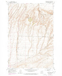
Other maps of this area

1908 · Umatilla
USGS Topo · 1:125,000

1917 · Pasco
USGS Topo · 1:125,000

1953 · Pendleton
USGS Topo · 1:250,000

1953 · Walla Walla
USGS Topo · 1:250,000

1956 · Pendleton
USGS Topo · 1:250,000

1958 · Walla Walla
USGS Topo · 1:250,000

1962 · Hat Rock
USGS Topo · 1:24,000

1962 · Juniper
USGS Topo · 1:24,000

1962 · Umatilla
USGS Topo · 1:24,000
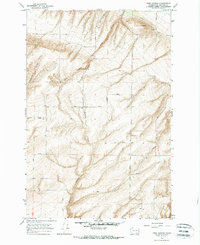
1964 · Nine Canyon
USGS Topo · 1:24,000