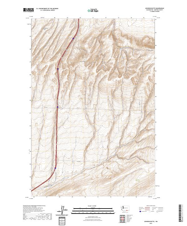
2023 Map of Johnson Butte
USGS Topo · Published 2023About this map
The Horse Heaven Hills define the high upland landscape of this portion of Benton County, a region characterized by deep drainage systems and prominent peaks like Johnson Butte. The topography is etched by a series of significant geographic features, including Zintel Canyon, Prospect Canyon, and Fourmile Canyon, which cut through the elevated terrain. These natural corridors have long influenced local transit, as seen in the alignment of Bofer Canyon Rd through the eponymous Bofer Canyon. Transportation in this rural area relies on a network of established routes such as Beck Rd, Coffin Rd, and Owens Rd, which connect the scattered high-elevation points. Near the eastern edge, the landmark known as Jump Off Joe overlooks the surrounding slopes, reached by the dedicated Jump Off Joe Rd.
Find a feature on this map
17 named features on this map. Tap any name to fly to it.
Don’t see what you’re looking for? This feature index may not catch every label — zoom into the map to look around manually.
Map Details
Editions of this 2023 Johnson Butte Map
This is the sole edition of this map. No revisions or reprints were ever made.
Other maps of this area

1908 · Umatilla
USGS Topo · 1:125,000

1917 · Pasco
USGS Topo · 1:125,000

1953 · Pendleton
USGS Topo · 1:250,000

1953 · Walla Walla
USGS Topo · 1:250,000

1956 · Pendleton
USGS Topo · 1:250,000

1958 · Walla Walla
USGS Topo · 1:250,000

1962 · Hat Rock
USGS Topo · 1:24,000

1962 · Juniper
USGS Topo · 1:24,000

1962 · Umatilla
USGS Topo · 1:24,000
1964 · Johnson Butte
USGS Topo · 1:24,000