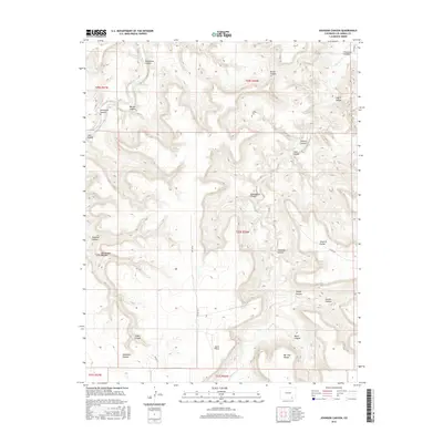
2016 Map of Johnson Canyon
USGS Topo · Published 2016About this map
Purgatoire River meanders through the northwest corner of this Las Animas County landscape, carving the deep Purgatoire Canyon through the high plains. The territory is defined by an intricate network of drainage systems, including Chacuaco Cr and numerous named canyons like Johnson Canyon, Umbrella Canyon, and Whitewater Canyon. This topography created natural basins and enclosures known locally as pockets, such as Seven D Pocket and Bar Four Pocket, which historically served as manageable grazing areas for livestock in a complex vertical environment.
Find a feature on this map
37 named features on this map. Tap any name to fly to it.
Don’t see what you’re looking for? This feature index may not catch every label — zoom into the map to look around manually.
Map Details
Editions of this 2016 Johnson Canyon Map
This is the sole edition of this map. No revisions or reprints were ever made.
Other maps of this area

1891 · Timpas
USGS Topo · 1:125,000

1891 · Mesa De Maya
USGS Topo · 1:125,000

1893 · Mesa de Maya
USGS Topo · 1:125,000

1894 · Timpas
USGS Topo · 1:125,000

1955 · La Junta
USGS Topo · 1:250,000

1958 · La Junta
USGS Topo · 1:250,000

1968 · La Junta
USGS Topo · 1:250,000

1972 · Johnson Canyon
USGS Topo · 1:24,000

1972 · Doss Canyon North
USGS Topo · 1:24,000

1972 · Plum Canyon
USGS Topo · 1:24,000