
1972 Map of Plum Canyon
USGS Topo · Published 1975About this map
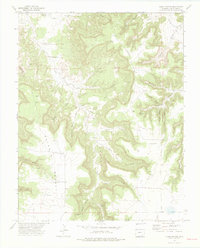
Courthouse Rock stands as a prominent landmark in this Colorado canyon landscape, which was meticulously documented in the early 1970s. The area is defined by a complex network of drainages, including the central Plum Canyon and its many tributaries such as Deadman Canyon, Indian Canyon, and Yeiser Canyon. This survey reveals the vital importance of water management in a semi-arid environment, noted by the presence of the Seven D Well, Plum Windmill, and several improved water sources like H J Water Spring.
Find a feature on this map
30 named features on this map. Tap any name to fly to it.
Don’t see what you’re looking for? This feature index may not catch every label — zoom into the map to look around manually.
Map Details
Editions of this 1972 Plum Canyon Map
3 editions found
Other maps of this area

1891 · Higbee
USGS Topo · 1:125,000

1891 · Timpas
USGS Topo · 1:125,000

1891 · Mesa De Maya
USGS Topo · 1:125,000

1892 · Mt Carrizo
USGS Topo · 1:125,000

1893 · Higbee
USGS Topo · 1:125,000

1893 · Mesa de Maya
USGS Topo · 1:125,000

1894 · Timpas
USGS Topo · 1:125,000

1955 · La Junta
USGS Topo · 1:250,000

1958 · La Junta
USGS Topo · 1:250,000

1968 · La Junta
USGS Topo · 1:250,000