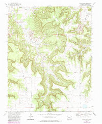
1972 Map of Plum Canyon
USGS Topo · Published 1985About this map
The canyonlands of southern Colorado's high plains are defined here by a network of drainage systems feeding into Plum Creek, documented by the U.S. Geological Survey during the 1970s and 1980s. The landscape is characterized by prominent landmarks like Courthouse Rock and a complex series of deep draws including Deadman Canyon and Indian Trail Canyon. This era shows a ranching landscape dependent on localized water sources, evidenced by the distribution of the Seven D Well, Seven D Tank, and numerous windmills such as the Reed Canyon Windmill. Transportation is limited to the eastern Villegreen Road and several unimproved paths, including a marked Jeep Trail, illustrating the remote nature of this part of Las Animas County. The concentration of features named after the Seven D brand, including Seven D Pocket, points to the historic ranching operations that utilized these canyons for livestock management and shelter.
Find a feature on this map
31 named features on this map. Tap any name to fly to it.
Don’t see what you’re looking for? This feature index may not catch every label — zoom into the map to look around manually.
Map Details
Editions of this 1972 Plum Canyon Map
3 editions found

Other maps of this area

1891 · Higbee
USGS Topo · 1:125,000

1891 · Timpas
USGS Topo · 1:125,000

1891 · Mesa De Maya
USGS Topo · 1:125,000

1892 · Mt Carrizo
USGS Topo · 1:125,000

1893 · Higbee
USGS Topo · 1:125,000

1893 · Mesa de Maya
USGS Topo · 1:125,000

1894 · Timpas
USGS Topo · 1:125,000

1955 · La Junta
USGS Topo · 1:250,000

1958 · La Junta
USGS Topo · 1:250,000

1968 · La Junta
USGS Topo · 1:250,000