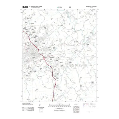
2011 Map of Johnson City
USGS Topo · Published 2011About this map
Johnson City expands across this landscape, where the academic grounds of East Tennessee State University and the historical site of Tipton-Haynes Farm meet. The terrain is marked by distinctive elevations like Tannery Knobs and Master Knob, which overlook a network of established neighborhoods such as Oakland Gardens and Montcastle Hills. This era shows the deep integration of education and local history, with Milligan College and its associated Milligan College Post Office serving the eastern portion of the map.
Find a feature on this map
198 named features on this map. Tap any name to fly to it.
Don’t see what you’re looking for? This feature index may not catch every label — zoom into the map to look around manually.
Map Details
Editions of this 2011 Johnson City Map
This is the sole edition of this map. No revisions or reprints were ever made.
Other maps of this area

1891 · Roan Mountain
USGS Topo · 1:125,000

1894 · Roan Mountain
USGS Topo · 1:125,000

1904 · Roan Mountain
USGS Topo · 1:125,000

1934 · Iron Mtn Gap
USGS Topo · 1:24,000

1935 · Watauga Valley
USGS Topo · 1:48,000

1935 · Erwin
USGS Topo · 1:24,000

1935 · Spurgeon
USGS Topo · 1:24,000

1935 · Elizabethton
USGS Topo · 1:24,000
1935 · Unicoi
USGS Topo · 1:24,000
1935 · Bluff City
USGS Topo · 1:24,000