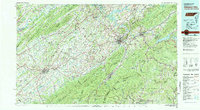
1980 Map of Johnson City
USGS Topo · Published 1981About this map
Bays Mountain and the Unaka Mountains frame this region of East Tennessee and North Carolina during a period of significant industrial and educational development. The map details the urban centers of Johnson City, Greeneville, and Elizabethton as they existed in the early 1980s, alongside several notable academic institutions including Washington College, Tusculum College, and Milligan College.
Find a feature on this map
112 named features on this map. Tap any name to fly to it.
Don’t see what you’re looking for? This feature index may not catch every label — zoom into the map to look around manually.
Map Details
Editions of this 1980 Johnson City Map
This is the sole edition of this map. No revisions or reprints were ever made.
Other maps of this area

1883 · Morristown
USGS Topo · 1:125,000

1887 · Jonesville
USGS Topo · 1:125,000

1891 · Roan Mountain
USGS Topo · 1:125,000

1891 · Abingdon
USGS Topo · 1:125,000

1891 · Jonesville
USGS Topo · 1:125,000

1892 · Greeneville
USGS Topo · 1:125,000

1893 · Cranberry
USGS Topo · 1:125,000

1893 · Mt Guyot
USGS Topo · 1:125,000

1893 · Morristown
USGS Topo · 1:125,000

1894 · Asheville
USGS Topo · 1:125,000