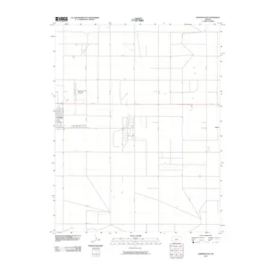
2010 Map of Johnson East
USGS Topo · Published 2010About this map
Johnson anchors the western edge of this agricultural landscape in Stanton County, characterized by a highly structured grid of section roads and pivot irrigation fields. As the county seat, the community's residential and commercial grid transitions quickly into the expansive High Plains farmland typical of the region. The Stanton County Municipal Airport sits just north of town, serving as a hub for aerial application and regional travel. Further east, the small settlement of Julian is located along the intersection of E Rd 12 and S Rd F, reflecting the dispersed nature of human habitation in this part of Kansas. The southern reaches of the quadrangle are marked by the winding path of Sand Arroyo Creek, which provides a natural break in the geometric road network defined by thoroughfares like E Rd 17 and S Rd J.
Find a feature on this map
25 named features on this map. Tap any name to fly to it.
Don’t see what you’re looking for? This feature index may not catch every label — zoom into the map to look around manually.
Map Details
Editions of this 2010 Johnson East Map
This is the sole edition of this map. No revisions or reprints were ever made.
Other maps of this area

1900 · Syracuse
USGS Topo · 1:125,000

1920 · Syracuse
USGS Topo · 1:125,000

1955 · Dodge City
USGS Topo · 1:250,000

1958 · Dodge City
USGS Topo · 1:250,000

1959 · Dodge City
USGS Topo · 1:250,000

1959 · Big Bow NE
USGS Topo · 1:24,000

1959 · Big Bow NW
USGS Topo · 1:24,000

1959 · Big Bow SW
USGS Topo · 1:24,000
1959 · Big Bow
USGS Topo · 1:24,000

1973 · Shore Airport
USGS Topo · 1:24,000