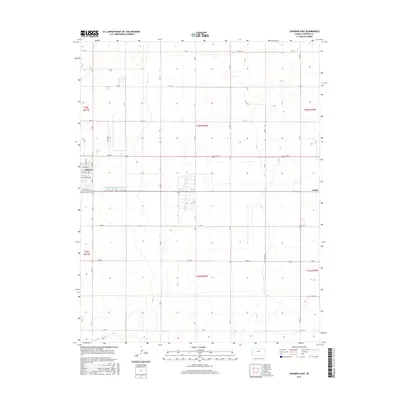
2015 Map of Johnson East
USGS Topo · Published 2015About this map
Johnson anchors the western edge of this High Plains landscape in Stanton County, showing the orderly expansion of the settlement along streets like E Grant Ave and E Highland Ave. The map captures the agricultural rhythm of the region, where the section-line road network, including the intersection of Airport Rd and E Rd 12, facilitates movement across the expansive townships. The drainage of Sand Arroyo Cr cuts across the southwest corner, offering a rare break in the geometric precision of the township and range survey lines. To the east, the location of Julian marks a distinct point in the rural landscape, illustrating the sparse but deliberate distribution of named places in this western Kansas territory.
Find a feature on this map
39 named features on this map. Tap any name to fly to it.
Don’t see what you’re looking for? This feature index may not catch every label — zoom into the map to look around manually.
Map Details
Editions of this 2015 Johnson East Map
This is the sole edition of this map. No revisions or reprints were ever made.
Other maps of this area

1900 · Syracuse
USGS Topo · 1:125,000

1920 · Syracuse
USGS Topo · 1:125,000

1955 · Dodge City
USGS Topo · 1:250,000

1958 · Dodge City
USGS Topo · 1:250,000

1959 · Dodge City
USGS Topo · 1:250,000

1959 · Big Bow NE
USGS Topo · 1:24,000

1959 · Big Bow NW
USGS Topo · 1:24,000

1959 · Big Bow SW
USGS Topo · 1:24,000
1959 · Big Bow
USGS Topo · 1:24,000

1973 · Shore Airport
USGS Topo · 1:24,000