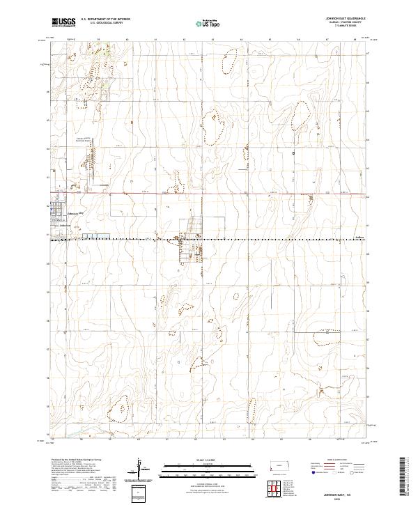
2022 Map of Johnson East
USGS Topo · Published 2022About this map
Johnson City and its southern counterpart Johnson anchor the western edge of this High Plains landscape, situated at the intersection of a rigid section-line road network. The town layout is clearly defined by residential streets such as E Ellsworth Ave and E Highland Ave, illustrating the planned grid of the Stanton County seat. To the north, the Stanton County Municipal Airport is accessed via Airport Rd, serving as a vital link for this agricultural region. Moving east, the terrain is characterized by expansive ranch and farm tracts, with the minor settlement of Julian located on the eastern boundary. The topography remains largely flat, though the presence of Sand Arroyo Cr in the southwest corner indicates the natural drainage patterns that have shaped the local grazing and cultivation history.
Find a feature on this map
37 named features on this map. Tap any name to fly to it.
Don’t see what you’re looking for? This feature index may not catch every label — zoom into the map to look around manually.
Map Details
Editions of this 2022 Johnson East Map
This is the sole edition of this map. No revisions or reprints were ever made.
Other maps of this area

1900 · Syracuse
USGS Topo · 1:125,000

1920 · Syracuse
USGS Topo · 1:125,000

1955 · Dodge City
USGS Topo · 1:250,000

1958 · Dodge City
USGS Topo · 1:250,000

1959 · Dodge City
USGS Topo · 1:250,000

1959 · Big Bow NE
USGS Topo · 1:24,000

1959 · Big Bow NW
USGS Topo · 1:24,000

1959 · Big Bow SW
USGS Topo · 1:24,000
1959 · Big Bow
USGS Topo · 1:24,000

1973 · Shore Airport
USGS Topo · 1:24,000