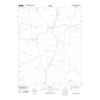
2010 Map of Johnson Hollow
USGS Topo · Published 2010About this map
Johnson Hollow and the surrounding drainage of Saline Creek define this landscape in Trigg County, where a network of family-named roads and scattered burial grounds trace the history of rural settlement. The geography is marked by numerous stream branches, including Scott Branch, Dry Fork Creek, and Shelby Creek, which carve out the hollows where local families established themselves.
Find a feature on this map
44 named features on this map. Tap any name to fly to it.
Don’t see what you’re looking for? This feature index may not catch every label — zoom into the map to look around manually.
Map Details
Editions of this 2010 Johnson Hollow Map
This is the sole edition of this map. No revisions or reprints were ever made.
Other maps of this area

1936 · Tharpe
USGS Topo · 1:24,000

1950 · Caledonia
USGS Topo · 1:24,000

1951 · Caledonia
USGS Topo · 1:24,000

1951 · Model
USGS Topo · 1:24,000

1951 · Roaring Spring
USGS Topo · 1:24,000

1951 · Johnson Hollow
USGS Topo · 1:24,000
1951 · Tharpe
USGS Topo · 1:24,000

1951 · Indian Mound
USGS Topo · 1:24,000

1951 · Bumpus Mills
USGS Topo · 1:24,000

1953 · Canton
USGS Topo · 1:24,000