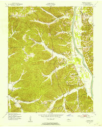
1951 Map of Tharpe
USGS Topo · Published 1953About this map
The Cumberland River carves the eastern edge of this Stewart County landscape, where deep hollows like Crutcher Hollow and Fox Hollow dictate the pattern of rural settlement. In the early 1950s, the community of Tharpe serves as a central point for the surrounding farmsteads, anchored by the Tharpe Ch and the Tharpe settlement itself. Further north, the village of Neville sits near the headwaters of Neville Creek, illustrating the historical reliance on local water sources and valley floors for habitation.
Find a feature on this map
65 named features on this map. Tap any name to fly to it.
Don’t see what you’re looking for? This feature index may not catch every label — zoom into the map to look around manually.
Map Details
Editions of this 1951 Tharpe Map
This is the sole edition of this map. No revisions or reprints were ever made.
Other maps of this area

1936 · Tharpe
USGS Topo · 1:24,000

1936 · Hamlin
USGS Topo · 1:24,000

1936 · Centerville Landing
USGS Topo · 1:24,000

1936 · Rushing
USGS Topo · 1:24,000

1936 · Standing Rock
USGS Topo · 1:24,000

1936 · Dover
USGS Topo · 1:24,000

1950 · Rushing Creek
USGS Topo · 1:24,000
1950 · Paris Landing
USGS Topo · 1:24,000

1950 · Standing Rock
USGS Topo · 1:24,000
1950 · Hamlin
USGS Topo · 1:24,000