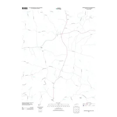
2013 Map of Johnson Hollow
USGS Topo · Published 2013About this map
Johnson Hollow and the surrounding drainage of Dry Cr define this rural landscape on the border of Kentucky and Tennessee. The map reveals a high density of family cemeteries, including the Moore Cem, Lancaster Cem, and Atkins Cem, suggesting long-standing family landholdings and small-scale agrarian roots throughout the region. The southeastern corner is notably occupied by a portion of the Fort Campbell Military Res, creating a distinct boundary between public residential roads and restricted federal land.
Find a feature on this map
57 named features on this map. Tap any name to fly to it.
Don’t see what you’re looking for? This feature index may not catch every label — zoom into the map to look around manually.
Map Details
Editions of this 2013 Johnson Hollow Map
This is the sole edition of this map. No revisions or reprints were ever made.
Other maps of this area

1936 · Tharpe
USGS Topo · 1:24,000

1950 · Caledonia
USGS Topo · 1:24,000

1951 · Caledonia
USGS Topo · 1:24,000

1951 · Model
USGS Topo · 1:24,000

1951 · Roaring Spring
USGS Topo · 1:24,000

1951 · Johnson Hollow
USGS Topo · 1:24,000
1951 · Tharpe
USGS Topo · 1:24,000

1951 · Indian Mound
USGS Topo · 1:24,000

1951 · Bumpus Mills
USGS Topo · 1:24,000

1953 · Canton
USGS Topo · 1:24,000