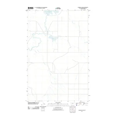
2011 Map of Johnson Lake
USGS Topo · Published 2011About this map
Johnson Lake and Homestead Lake anchor this 2011 survey of the northeast Montana plains, where the meandering course of Big Muddy Creek defines the local topography. This landscape is shaped by the drainage patterns of seasonal and perennial waterways, including Sheep Creek and Sand Creek, which cut through the open country. The road network is sparse, centered on the transit route of Fas 344 and the uniquely named The Slab Rd. This map reflects the quiet, rural character of the Fort Kipp District, preserving the contemporary layout of water sources and property access roads essential for local ranching and agricultural operations in Roosevelt and Sheridan counties.
Find a feature on this map
7 named features on this map. Tap any name to fly to it.
Don’t see what you’re looking for? This feature index may not catch every label — zoom into the map to look around manually.
Map Details
Editions of this 2011 Johnson Lake Map
This is the sole edition of this map. No revisions or reprints were ever made.
Other maps of this area

1914 · Homestead
USGS Topo · 1:62,500

1947 · Rocky Point
USGS Topo · 1:24,000

1947 · Homestead
USGS Topo · 1:24,000

1948 · Homestead
USGS Topo · 1:24,000

1948 · Rocky Point
USGS Topo · 1:24,000

1948 · Medicine Lake
USGS Topo · 1:24,000

1948 · Fort Kipp
USGS Topo · 1:24,000

1949 · Fort Kipp
USGS Topo · 1:24,000
1949 · Medicine Lake
USGS Topo · 1:24,000

1949 · Johnson Lake
USGS Topo · 1:24,000