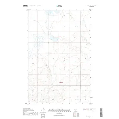
2020 Map of Johnson Lake
USGS Topo · Published 2020About this map
Big Muddy Creek meanders through the northwest corner of this Roosevelt County landscape, defining a wide, marshy basin that includes Johnson Lake and Homestead Lake. The terrain transitions from these low-lying wetlands into the higher, dissected plateaus of the Missouri Coteau, where intermittent drainages like Sheep Cr and Sand Cr have carved intricate coulees into the prairie. The map shows a strictly gridded section-line road system characteristic of the High Plains, with local routes such as W Froid Rd and Stab Rd providing access to remote ranching and agricultural tracts. This 2020 survey documents the intersection of t30n r55e and t29n r55e, capturing a sparsely populated corner of northeastern Montana where water remains the primary driver of the land's utility and character.
Find a feature on this map
17 named features on this map. Tap any name to fly to it.
Don’t see what you’re looking for? This feature index may not catch every label — zoom into the map to look around manually.
Map Details
Editions of this 2020 Johnson Lake Map
This is the sole edition of this map. No revisions or reprints were ever made.
Other maps of this area

1914 · Homestead
USGS Topo · 1:62,500

1947 · Rocky Point
USGS Topo · 1:24,000

1947 · Homestead
USGS Topo · 1:24,000

1948 · Homestead
USGS Topo · 1:24,000

1948 · Rocky Point
USGS Topo · 1:24,000

1948 · Medicine Lake
USGS Topo · 1:24,000

1948 · Fort Kipp
USGS Topo · 1:24,000

1949 · Fort Kipp
USGS Topo · 1:24,000
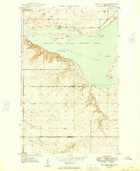
1949 · Medicine Lake
USGS Topo · 1:24,000

1949 · Johnson Lake
USGS Topo · 1:24,000