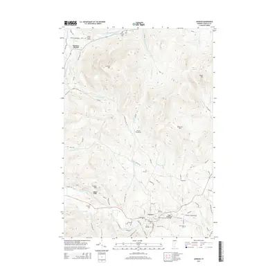
2015 Map of Johnson
USGS Topo · Published 2015About this map
Johnson serves as the focal point for this Lamoille County landscape, situated at the convergence of the Lamoille River and the Gihon River. In the mid-2010s, the town's character is defined by the prominent campus of Johnson State Coll and a network of valleys stretching into the Green Mountains. To the north, the terrain rises toward Laraway Mtn and Butternut Mtn, while the rural outskirts are dotted with local history markers like the Center Cem near Belvidere Center and the Plot Cem on the hillsides above the river valley. The region's architectural heritage remains visible through preserved crossings such as the Mill Covered Bridge and Scribner Covered Bridge. Along the waterways, landmarks like Ithiel Falls and numerous smaller tributaries including Foot Brook and Bell Brook illustrate the intricate drainage patterns that have shaped the agricultural and residential development of this Vermont township.
Find a feature on this map
87 named features on this map. Tap any name to fly to it.
Don’t see what you’re looking for? This feature index may not catch every label — zoom into the map to look around manually.
Map Details
Editions of this 2015 Johnson Map
This is the sole edition of this map. No revisions or reprints were ever made.
Other maps of this area

1919 · Montgomery
USGS Topo · 1:62,500

1920 · Franklin Pond
USGS Topo · 1:62,500

1920 · Montgomery
USGS Topo · 1:62,500

1922 · Enosburg Falls
USGS Topo · 1:48,000

1924 · Enosburg Falls
USGS Topo · 1:62,500

1925 · Jay Peak
USGS Topo · 1:62,500

1925 · Mount Mansfield
USGS Topo · 1:48,000

1927 · Mount Mansfield
USGS Topo · 1:62,500

1927 · Hyde Park
USGS Topo · 1:48,000

1930 · Hyde Park
USGS Topo · 1:62,500