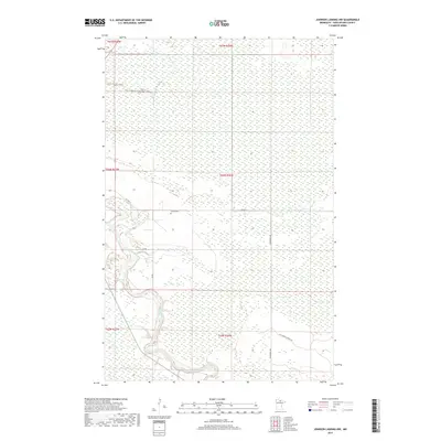
2019 Map of Johnson Landing NW
USGS Topo · Published 2019About this map
The Big Fork River carves a winding path through the heavy wetlands of northern Minnesota, defining the drainage and topography of this Koochiching County landscape. The river's serpentine course is the primary landmark in an otherwise saturated terrain dominated by peatlands and forests. Local history is anchored by the Larson Cem, situated near the junction of Co Hwy 31 and several unpaved transit routes. The transport network is sparse, consisting largely of utilitarian forest roads such as Cut Across Forest Rd and Dentaybow Rd, which provide access through the remote backcountry. The map provides a detailed view of the Public Land Survey System grid, including the meeting point of townships T67N, T66N, and T65N across ranges R27W and R26W.
Find a feature on this map
14 named features on this map. Tap any name to fly to it.
Don’t see what you’re looking for? This feature index may not catch every label — zoom into the map to look around manually.
Map Details
Editions of this 2019 Johnson Landing NW Map
This is the sole edition of this map. No revisions or reprints were ever made.
Other maps of this area

1919 · Happy Land
USGS Topo · 1:62,500

1919 · M
USGS Topo · 1:62,500

1919 · Margie
USGS Topo · 1:62,500

1943 · Lindford
USGS Topo · 1:62,500

1954 · International Falls
USGS Topo · 1:250,000

1957 · International Falls
USGS Topo · 1:250,000

1958 · International Falls
USGS Topo · 1:250,000

1970 · Johnson Landing SE
USGS Topo · 1:24,000

1970 · Littlefork SE
USGS Topo · 1:24,000

1970 · Littlefork SW
USGS Topo · 1:24,000