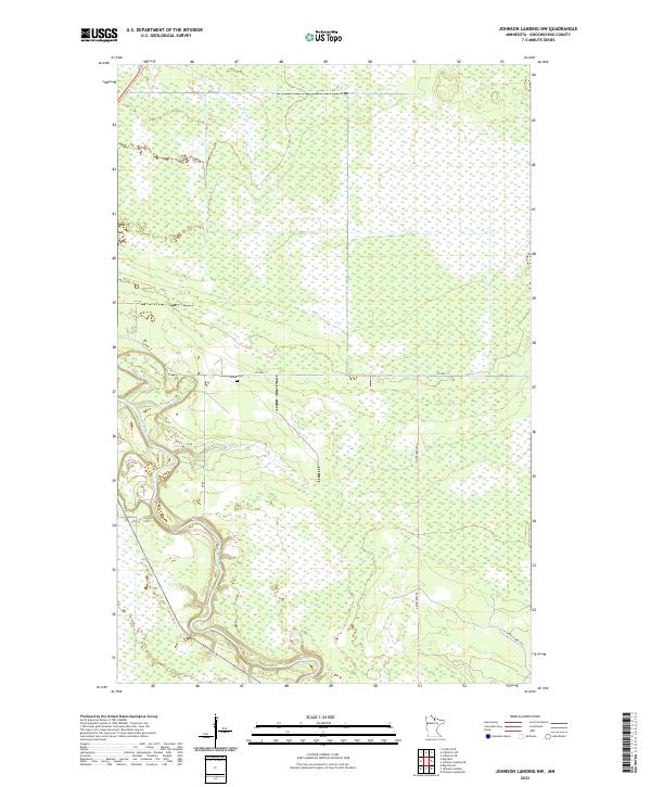
2022 Map of Johnson Landing NW
USGS Topo · Published 2022About this map
The Big Fork River carves a winding path through the wetland-dominated landscape of southwestern Koochiching County, joined in the north by the waters of the Bear River. This 2022 survey documents a sparsely populated region of northern Minnesota where the heavy saturation of the land is evident in the expansive marshes and peatlands that dominate the township lines. Human presence is concentrated along a handful of corridors, most notably Co Hwy 31 which traverses the central portion of the map near the Larson Cem. Further south, the landscape is accessible via primitive routes such as Dentaybow Rd and Cut Across Forest Rd, indicating a terrain primarily managed for timber or conservation rather than dense settlement. The map provides a clear record of the intersection between these limited access roads and the natural hydrology of the Big Fork basin.
Find a feature on this map
14 named features on this map. Tap any name to fly to it.
Don’t see what you’re looking for? This feature index may not catch every label — zoom into the map to look around manually.
Map Details
Editions of this 2022 Johnson Landing NW Map
This is the sole edition of this map. No revisions or reprints were ever made.
Other maps of this area

1919 · Happy Land
USGS Topo · 1:62,500

1919 · M
USGS Topo · 1:62,500

1919 · Margie
USGS Topo · 1:62,500

1943 · Lindford
USGS Topo · 1:62,500

1954 · International Falls
USGS Topo · 1:250,000

1957 · International Falls
USGS Topo · 1:250,000

1958 · International Falls
USGS Topo · 1:250,000

1970 · Johnson Landing SE
USGS Topo · 1:24,000

1970 · Littlefork SE
USGS Topo · 1:24,000

1970 · Littlefork SW
USGS Topo · 1:24,000