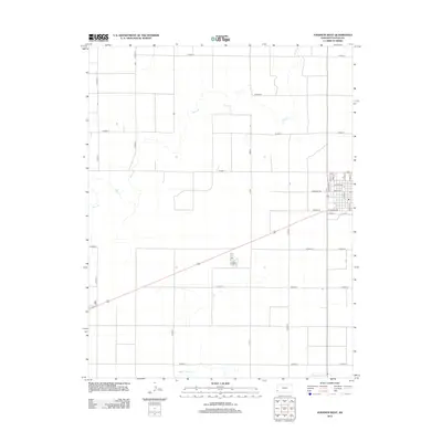
2012 Map of Johnson West
USGS Topo · Published 2012About this map
The western reaches of Stanton County are defined by a strict section-line grid of rural roads and the meandering courses of prairie waterways. This 2012 survey shows the residential core and commercial outskirts of a small plains community, anchored by essential civic landmarks including the local Po and a historic Cem located along Cemetery Rd. The landscape is a study in agricultural geometry, where long stretches of W Road 9 and W Road 17 cross a terrain occasionally interrupted by the drainage of Bear Ck and Sand Arroyo Cr. Street names such as Logan Ave, Grant Ave, and W Highlander trace the local street plan, providing a clear reference for genealogists and local historians tracking property locations and community growth in the early 21st century.
Find a feature on this map
36 named features on this map. Tap any name to fly to it.
Don’t see what you’re looking for? This feature index may not catch every label — zoom into the map to look around manually.
Map Details
Editions of this 2012 Johnson West Map
This is the sole edition of this map. No revisions or reprints were ever made.
Other maps of this area

1900 · Syracuse
USGS Topo · 1:125,000

1920 · Syracuse
USGS Topo · 1:125,000

1955 · Dodge City
USGS Topo · 1:250,000

1958 · Dodge City
USGS Topo · 1:250,000

1959 · Dodge City
USGS Topo · 1:250,000

1959 · Big Bow NW
USGS Topo · 1:24,000

1959 · Big Bow SW
USGS Topo · 1:24,000

1973 · Richfield NW
USGS Topo · 1:24,000
1973 · Johnson NW
USGS Topo · 1:24,000

1973 · Shore Airport
USGS Topo · 1:24,000