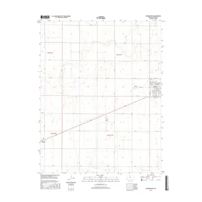
2015 Map of Johnson West
USGS Topo · Published 2015About this map
Stanton County's agricultural high plains are defined by a rigid section-line grid of rural roads and the subtle relief of the High Plains terrain. The settlement of Johnson serves as the primary local hub, with its residential streets including W Weaver Ave, W Lincoln Ave, and W Highland Ave concentrated on the eastern edge of the survey. To the west, the village of Manter stands at the intersection of local routes, providing a second point of human activity in this expansive landscape.
Find a feature on this map
48 named features on this map. Tap any name to fly to it.
Don’t see what you’re looking for? This feature index may not catch every label — zoom into the map to look around manually.
Map Details
Editions of this 2015 Johnson West Map
This is the sole edition of this map. No revisions or reprints were ever made.
Other maps of this area

1900 · Syracuse
USGS Topo · 1:125,000

1920 · Syracuse
USGS Topo · 1:125,000

1955 · Dodge City
USGS Topo · 1:250,000

1958 · Dodge City
USGS Topo · 1:250,000

1959 · Dodge City
USGS Topo · 1:250,000

1959 · Big Bow NW
USGS Topo · 1:24,000

1959 · Big Bow SW
USGS Topo · 1:24,000

1973 · Richfield NW
USGS Topo · 1:24,000
1973 · Johnson NW
USGS Topo · 1:24,000

1973 · Shore Airport
USGS Topo · 1:24,000