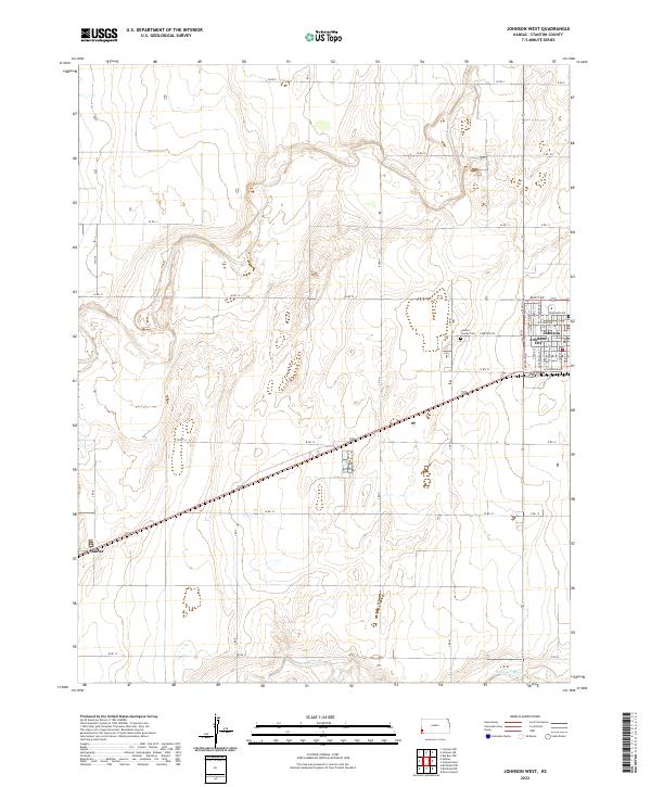
2022 Map of Johnson West
USGS Topo · Published 2022About this map
Johnson City and the small town of Manter anchor this corner of the High Plains, where the grid of the Public Land Survey System strictly governs the landscape. The terrain is characterized by the seasonal drainage of Sand Arroyo Cr and a vast network of section-line roads such as W RD 12 and S RD P, which reflect the agricultural heritage of Stanton County. This modern survey illustrates the transition from traditional farmsteads to the current rural infrastructure, with the Stanton County Cem serving as a significant landmark for genealogists and local historians tracking family roots in the region. The map’s precise detail includes municipal street names in Johnson City, such as W Weaver Ave and S Elm St, providing a clear view of the settlement patterns that have persisted in this western Kansas landscape.
Find a feature on this map
46 named features on this map. Tap any name to fly to it.
Don’t see what you’re looking for? This feature index may not catch every label — zoom into the map to look around manually.
Map Details
Editions of this 2022 Johnson West Map
This is the sole edition of this map. No revisions or reprints were ever made.
Other maps of this area

1900 · Syracuse
USGS Topo · 1:125,000

1920 · Syracuse
USGS Topo · 1:125,000

1955 · Dodge City
USGS Topo · 1:250,000

1958 · Dodge City
USGS Topo · 1:250,000

1959 · Dodge City
USGS Topo · 1:250,000

1959 · Big Bow NW
USGS Topo · 1:24,000

1959 · Big Bow SW
USGS Topo · 1:24,000

1973 · Richfield NW
USGS Topo · 1:24,000
1973 · Johnson NW
USGS Topo · 1:24,000

1973 · Shore Airport
USGS Topo · 1:24,000