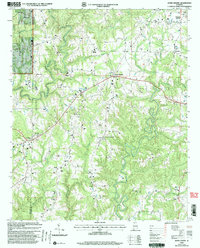
2000 Map of Jones Chapel
USGS Topo · Published 2003About this map
William B Bankhead National Forest defines the western edge of this landscape, where the terrain transitions across the Winston and Cullman County line. The area is characterized by a high density of rural religious and community centers, including Sardis Church and its accompanying Sardis Cemetery in the northwest, and White Oak Church near the center of the sheet. The settlement pattern follows the ridges above the winding paths of Blevens Creek and Sullivan Creek, with Jones Chapel serving as a central point of intersection for local roads.
Find a feature on this map
28 named features on this map. Tap any name to fly to it.
Don’t see what you’re looking for? This feature index may not catch every label — zoom into the map to look around manually.
Map Details
Editions of this 2000 Jones Chapel Map
This is the sole edition of this map. No revisions or reprints were ever made.
Other maps of this area

1888 · Cullman
USGS Topo · 1:125,000

1892 · Cullman
USGS Topo · 1:125,000

1927 · Falkville
USGS Topo · 1:24,000

1935 · Upshaw
USGS Topo · 1:24,000

1935 · Danville
USGS Topo · 1:48,000

1936 · Mc Kendry
USGS Topo · 1:24,000

1938 · Danville
USGS Topo · 1:62,500

1949 · Falkville
USGS Topo · 1:24,000
1951 · Falkville
USGS Topo · 1:24,000

1956 · Gadsden
USGS Topo · 1:250,000