
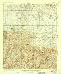
1938 Map of Danville
USGS Topo · Published 1938About this map
The Black Warrior National Forest dominates the southern landscape of this 1930s survey, a terrain of high ridges and narrow gaps including Washplace Mtn and Millfield Mtn. This upland region, marked by the Basham Fire Tower, transitions northward into a more settled agricultural corridor defined by the drainage of Flint Creek and its many branches. Small communities like Danville, Neel, and Stroups Crossroads serve as hubs for the surrounding farmsteads, many of which are situated near local landmarks like the McDaniel Bridge and Means Bridge. Genealogists will find a wealth of specific local detail, from family-named features like Torrence Hill and Isabel Mtn to numerous rural institutions such as Andrews Chapel and Cave Springs Sch. The map preserves the placement of late Depression-era infrastructure, including the remote settlement at Upshaw and the Camp Ground near the Morgan County line.
Find a feature on this map
96 named features on this map. Tap any name to fly to it.
Don’t see what you’re looking for? This feature index may not catch every label — zoom into the map to look around manually.
Map Details
Editions of this 1938 Danville Map
2 editions found
Other maps of this area

1888 · Cullman
USGS Topo · 1:125,000

1888 · Huntsville
USGS Topo · 1:125,000

1892 · Cullman
USGS Topo · 1:125,000

1892 · Huntsville
USGS Topo · 1:125,000

1927 · Falkville
USGS Topo · 1:24,000

1935 · Moulton
USGS Topo · 1:24,000

1935 · Upshaw
USGS Topo · 1:24,000

1935 · Danville
USGS Topo · 1:48,000

1935 · Oakville
USGS Topo · 1:24,000

1936 · Caddo
USGS Topo · 1:24,000