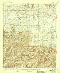
1938 Map of Danville
USGS Topo · Published 1938About this map
Oakville and Danville anchor this 1930s survey of the North Alabama landscape, where the terrain shifts from the agricultural lowlands of Big Bottom into the elevated reaches of the Black Warrior Mountains. The map reveals a dense network of early 20th-century rural life, marked by numerous country schools like Liberty Sch and Zion Sch, alongside community hubs at Stroups Crossroads and Neel.
Find a feature on this map
79 named features on this map. Tap any name to fly to it.
Don’t see what you’re looking for? This feature index may not catch every label — zoom into the map to look around manually.
Map Details
Editions of this 1938 Danville Map
2 editions found

Other maps of this area

1888 · Cullman
USGS Topo · 1:125,000

1888 · Huntsville
USGS Topo · 1:125,000

1892 · Cullman
USGS Topo · 1:125,000

1892 · Huntsville
USGS Topo · 1:125,000

1927 · Falkville
USGS Topo · 1:24,000

1935 · Moulton
USGS Topo · 1:24,000

1935 · Upshaw
USGS Topo · 1:24,000

1935 · Danville
USGS Topo · 1:48,000

1935 · Oakville
USGS Topo · 1:24,000

1936 · Caddo
USGS Topo · 1:24,000