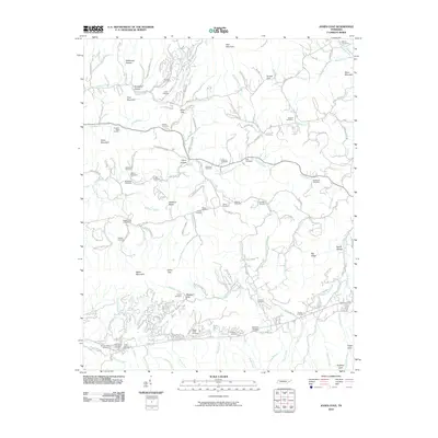
2010 Map of Jones Cove
USGS Topo · Published 2010About this map
Webb Mountain and Chestnut Ridge dominate this section of Sevier County, where the landscape is defined by deep hollows and narrow gaps. The 2010 geography reveals a dense network of family cemeteries that reflect the long-standing settlement patterns of the region, including the Webbs Creek Cemetery, Shults-Whaley Cemetery, and McCarter-Williams Cemetery. The area is drained by numerous winding waterways such as Dunn Creek, Chucky Creek, and Webb Creek, which carve through the terrain beneath peaks like Rich Mountain and Dixon Mountain. This survey illustrates the intricate road system following these natural contours, including E Pkwy and Waldroup Rd, connecting isolated gaps like Jones Gap and Blackgun Gap with the surrounding valleys and hollows.
Find a feature on this map
140 named features on this map. Tap any name to fly to it.
Don’t see what you’re looking for? This feature index may not catch every label — zoom into the map to look around manually.
Map Details
Editions of this 2010 Jones Cove Map
This is the sole edition of this map. No revisions or reprints were ever made.
Other maps of this area

1893 · Mt Guyot
USGS Topo · 1:125,000

1912 · Mt Guyot
USGS Topo · 1:125,000

1935 · Newport
USGS Topo · 1:48,000

1935 · Hartford
USGS Topo · 1:24,000

1935 · English Mountain
USGS Topo · 1:48,000

1935 · Clevenger
USGS Topo · 1:24,000

1935 · Jones Cove
USGS Topo · 1:24,000

1935 · Richardson Cove
USGS Topo · 1:24,000
1935 · Shady Grove
USGS Topo · 1:24,000
1936 · Cartertown
USGS Topo · 1:24,000