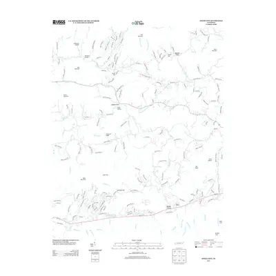
2013 Map of Jones Cove
USGS Topo · Published 2013About this map
Jones Cove sits at the heart of this Sevier County landscape, where numerous hollows and gaps define the movement of water and travelers through the Great Smoky Mountains foothills. The 2013 topography reveals a complex network of ridges, including Webb Mountain and Rich Mountain, separated by deep-cut valleys like Stillhouse Hollow and Spurgeon Hollow. This era's road system, featuring Henry Town Rd and Pearl Valley Rd, follows the natural contours established by original family settlements and farmsteads. South of the cove, Rocky Grove and Baxter's Orchard represent the enduring agricultural character of the region, while landmarks like Blackgun Gap and Sunset Gap mark the high passes between watersheds. The intricate drainage pattern of Dunn Cr, Webb Cr, and Chucky Cr illustrates how the geography dictated the placement of mountain communities and timber-access routes.
Find a feature on this map
186 named features on this map. Tap any name to fly to it.
Don’t see what you’re looking for? This feature index may not catch every label — zoom into the map to look around manually.
Map Details
Editions of this 2013 Jones Cove Map
This is the sole edition of this map. No revisions or reprints were ever made.
Other maps of this area

1893 · Mt Guyot
USGS Topo · 1:125,000

1912 · Mt Guyot
USGS Topo · 1:125,000

1935 · Newport
USGS Topo · 1:48,000

1935 · Hartford
USGS Topo · 1:24,000

1935 · English Mountain
USGS Topo · 1:48,000

1935 · Clevenger
USGS Topo · 1:24,000

1935 · Jones Cove
USGS Topo · 1:24,000

1935 · Richardson Cove
USGS Topo · 1:24,000
1935 · Shady Grove
USGS Topo · 1:24,000
1936 · Cartertown
USGS Topo · 1:24,000